The reason for less rainfall in India
The month of June has already come to and end and there are no signs of good monsoon rains yet. A major part of India is about to face a major problem of drought because of the lack of good monsoon rainfall. The winter of 2011 was much colder and longer than usual winter. The major reason for this is the El Nino effect in the Pacific ocean. It lasted for about 4 long months. The temperatures really dipped to a record low in European countries as well.
The summer of 2012 was a much cooler one with the temperatures soaring to about 40 degrees C in hottest parts of Indian sub continent. Places like Nagpur and Madhya Pradesh which experience some of the hottest summers in the country stayed cooler this summer by 2 to 4 degrees C. All this was happening because of the El Nino Effect in Pacific ocean. Lets have a clear look into what this El Nino effect has for us.
EL Niño
El Niño is the result of an on-going interaction between the ocean and atmosphere in the tropical Pacific Ocean. The El Niño effect occurs due to the combined interaction of oceanic currents and the atmospheric variations. This is commonly known as the El Niño Southern Oscillation (ENSO).
Normal conditions
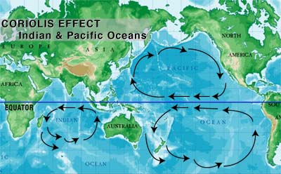
In normal conditions when there is no El Niño or La Nina, the pressure in the EASTERN pacific ocean is higher than the WESTERN pacific region. This is because, due the rotation of the earth, the trade winds blow from east to west. The pattern of trade winds and the relation with rotation of earth is clearly given by the Coriolis effect.
A good example of Coriolis Effect can be studied by viewing the image below:

Coriolis effect
Whenever an object from the center of the disc moves towards the periphery of the disc, due to the inertia, the object gets deflected. The original statement says that if the disc is moving in counter clockwise direction, the object will get deflected to the right!
This is what happens with the winds near the equator. Due the Coriolis effect, the winds at the equator get deflected and the wind pattern can be observed from the image above.
But, Coriolis effect alone is not responsible for the trade winds, other factors such as air pressure, temperature, ocean surface temperature also play an important role. And these are the factors which also play an important role in the El Nina effect.
The warm water from the equator also gets deflected and it begins to pile up in the western pacific region. Because the warm water has a greater volume, the height of the western pacific ocean is greater than the eastern Pacific by 30 cm.
Upwelling of cold, nutrient-rich water occurs along the western coast of South America.
The Southern Oscillations
It is the oscillation in which the atmospheric pressure and wind patterns shift across the Pacific ocean. The high pressure on the eastern Pacific region decreases and the normal low pressure on the Australia rises. When this occurs, El Nino can develop easily.
The warm water begins to move eastward and so do the convection currents. The warm water begins to pile up in the eastern region of Pacific ocean which is normally in the western Pacific ocean. Due to this, the heavy rains are caused by the increased buoyancy of the air warmed by the water surface.
Because of this reason, there are heavy rains in the Pacific islands and western coast of South America.
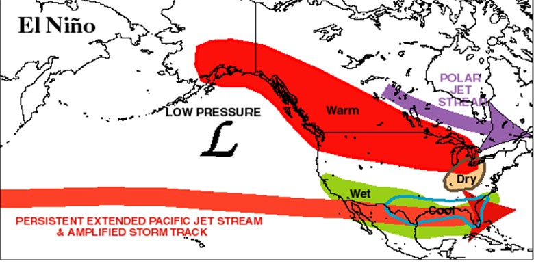
Latent Heat of condensation further warms the air decreasing the atmospheric pressure in the eastern Pacific region. This causes the thunderstorms to shift from the western Pacific to eastern Pacific and Central Pacific. The shift causes a massive disruption in the jet stream circulation.
Each El Nino event is unique and has different effects. The events across the globe are interconnected with each other and they are known as teleconnections.
Effect of El Nina on India
The El Nino event brings in a very cold and long lasting winter, which we just experienced this year and back in 2008. Having a cool winter is something which is enjoyed by a lot of Indians, but after winter comes the summer.
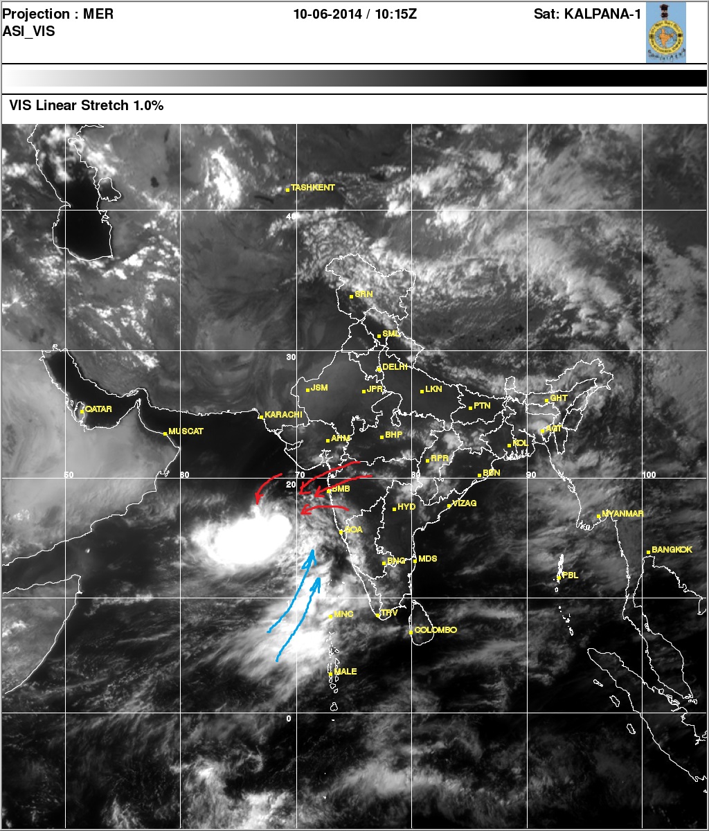
El Nino event is most likely followed by scarce rainfall in the Indian sub continent as well as in the south-east Asian countries. It is expected that due to the El Nino effect, there is a chance of drought this year. The research paper published by Andhra Pradesh Govt. states that in previous events of El Nino, the rainfall throughout Indian sub continent during the months of June, July and September were below normal.
Considering the current trend of Global warming, it is very likely that the rainfall this year could be much much below normal levels. It is better that we start using the water carefully because there are about 85% chances that we are about to face a major problem of DROUGHT!
It is advisable to everyone save water and harvest as much rainwater as possible by installing rain water harvesting units in your buildings, or however possible.
What comes next?
El Nino event is followed by a La Nina event most likely in a period of 2 to 5 years. During La Nina, Indian sub continent experiences heavy rainfall, just like we did in 2005. Again, considering the rapidly changing weather patterns it is advisable to stay alert and prepared for the worst, because Disaster can strike us without any warning.
Right now, we are looking at drought which can hit the Indian economy and most importantly the agriculture very hard.
UPDATE
As we had predicted, the rainfall this year has really been scanty throughout the western parts of India, although a major havoc has been caused due to extremely high rainfall in Eastern India. States of Assam and Orissa have been hit again due to floods caused by sudden rainfall. It can be clearly seen that the rainfall is not being concentrated in short windows of time. If we look back at the history or rainfalls we can see that the rainfall had been evenly distributed throughout the monsoon, but as we start to study rainfall patterns after 2000, the concentration of rainfall in short periods of time is clearly experienced.
Due to El Nino, these short bursts of rainfall are shifted towards east India, which will come back to Western India (Maharashtra, Madhya Pradesh) when the La Nina effect sets in. This pattern can be clearly seen if the rainfall pattern of past 8 to 10 years is studied.
Looking at the overall amount of rainfall, it is seen that there has been a slight decrease in rainfall. Although exact numbers are not available for this year, this report is based on visual observations and news reports.


well done baby….u can do very well :X…..n missing u alot :*
‘Coriolis Effect’ nicely explained.
I still remember those terrible days of 2005.
We could expect extreme weather events in near future.
Weather events would get concentrated over short periods of time, like in case on monsoon, we get heavy rains in short amount of time.